We're restoring the waterside forests that recharge the Edwards Aquifer.
The Texas Riparian Project plants and protects native trees, grasses, and wildflowers along Hill Country waterways — rebuilding the living filter between the land we've built and the water we all drink.
A healthy riparian buffer slows stormwater, filters pollutants, and lets rainfall soak through karst limestone into the aquifer below.
A new organization, built for a long-term job.
The Texas Riparian Project is just getting underway. We're building our first restoration sites, recruiting our first volunteers, and establishing the landowner relationships that riparian work depends on — with a goal of measurable, verifiable progress on the ground, not big claims up front.
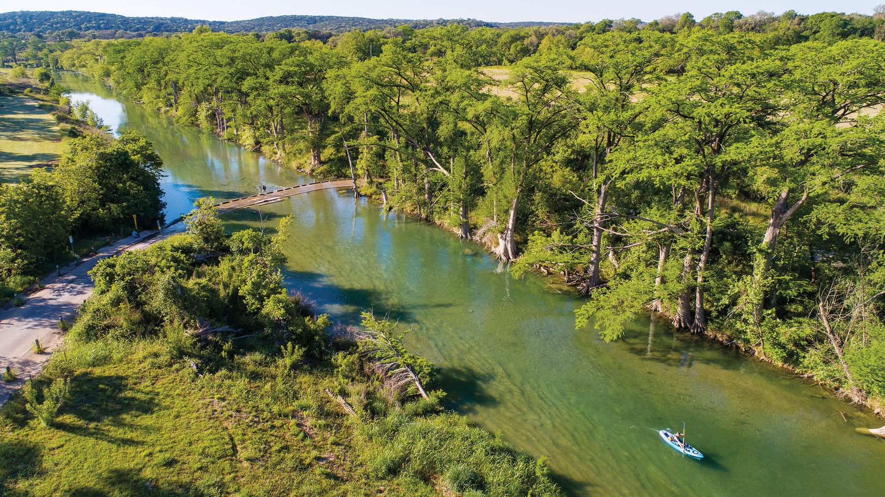
This is the goal: a continuous native canopy holding the bank, shading the water, and slowing every drop headed for the aquifer.
The narrow strip of green along a waterway does an outsized job.
Riparian zones — the bands of native vegetation growing along streambanks — are the last line of defense before rainfall either runs off as polluted stormwater or soaks into the ground to recharge the Edwards Aquifer, the sole source of drinking water for more than two million Central Texans. Where those zones have been cleared, paved, or overtaken by invasive species, recharge slows, banks erode, and waterways warm past what native fish and mussels can survive.
Native plantings on the ground
We design and install riparian buffers using species that historically grew along Hill Country waterways — bald cypress, cedar elm, buttonbush, and deep-rooted native grasses — chosen for bank stabilization, shade, and habitat.
Landowner & volunteer training
Most Hill Country waterway frontage is privately owned. We run workshops and one-on-one site visits that give landowners a practical plan for the stretch of waterway in their own backyard.
Long-term stewardship
Planting is the beginning, not the end. We monitor survival, manage invasive species like Chinaberry and King Ranch bluestem, and work with counties to keep restored corridors intact as land use changes.
What happens on the bank doesn't stay on the bank.
The Edwards Aquifer's recharge zone is a band of exposed, fractured limestone running through Central Texas where waterways lose their flow directly into the aquifer through swallets, sinkholes, and porous streambed. Water that enters clean recharges a resource shared by cities, ranches, and the endangered species of Comal and San Marcos Springs. Water that enters carrying sediment, fertilizer, or bacteria goes straight into that same supply, largely unfiltered by soil.
Because riparian vegetation is what slows, filters, and shades that water before it reaches the recharge features, the health of the aquifer is inseparable from the health of the waterway corridors feeding it.
Learn how recharge works
More than two million Central Texans — including Austin and San Antonio — draw their drinking water from the Edwards Aquifer.